Success on a cross-Canada drive isn’t about the gas stations on your map; it’s a mental game against landscape deception and your own complacency.
- Digital tools are unreliable in remote areas; real-world intel and a healthy dose of skepticism are your best navigators.
- The greatest dangers are often psychological, like “highway hypnosis” on the Prairies and underestimating the sheer scale of Northern Ontario.
Recommendation: Shift your planning from simply finding fuel to managing your attention, respecting “fuel commitment points,” and carrying a survival kit built for a multi-hour wait, not just a minor inconvenience.
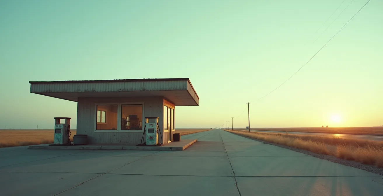
The idea of driving the Trans-Canada Highway is pure Canadiana. It’s a ribbon of asphalt stitching together a continent, a rite of passage promising epic vistas from the Atlantic coast to the Pacific rainforest. You’ve probably pictured it: cruising through the Rockies, witnessing the vastness of the Prairies. But between the dream and the reality lies a cold, hard truth, one that usually appears on your dashboard as a blinking fuel light somewhere between Wawa and Thunder Bay. The core anxiety for any long-haul driver isn’t the distance; it’s the emptiness. It’s the gnawing fear of running out of gas hundreds of kilometers from the nearest sign of life.
Most advice you’ll find is painfully generic. “Plan your route,” they say. “Bring a jerry can.” “Use a gas app.” This is beginner-level thinking that fails to grasp the fundamental challenge of the Canadian landscape. These tips are useless when your app has no signal, the station on your map closed two years ago, and you’re fighting a hypnotic trance induced by 300 kilometers of perfectly straight, featureless road. This isn’t just about logistics; it’s about survival, both for your vehicle and your mind.
So, let’s throw out the tourist guide. The real key to conquering the Trans-Canada isn’t just about managing your fuel tank; it’s about managing your own psychology. This guide is built on veteran knowledge—the hard-won lessons that teach you to respect the deceptive emptiness of the Canadian shield and the prairies. We’ll cover the mental traps, the gear that actually matters, the true time it takes to cross the country’s biggest hurdles, and how to make decisions when technology fails you. This is about understanding the road’s rhythm and knowing when to trust your gut over your GPS.
This article breaks down the essential survival strategies that veteran drivers use. We will explore the psychological dangers, the practicalities of navigation without cell service, critical route choices, and the non-negotiable gear you need to carry. Read on to arm yourself with the knowledge that truly matters.
Table of Contents: A Veteran’s Guide to the Trans-Canada Highway
- Why Is “Highway Hypnosis” Dangerous on the Prairies Straight Roads?
- How to Use Offline Maps When There is No Cell Service in the Rockies?
- Highway 1 vs. Yellowhead Highway: Which Route is Better for Wildlife?
- The Essential Trunk Kit: What Tools Must You Have for a 5,000 km Trip?
- Crossing Ontario: How Many Days Does It Really Take to Drive Across the Province?
- Combating Monotony: How to Stay Alert on Straight Roads for 8 Hours?
- High Beams vs. Fog Lights: Which Is Better for Illuminating Fur?
- Renting an RV in Alberta: What Size Vehicle Fits National Park Campsites?
Why Is “Highway Hypnosis” Dangerous on the Prairies Straight Roads?
Don’t let the Prairies fool you. The endless, flat horizon and ruler-straight roads seem easy, but they are one of the most psychologically taxing parts of the drive. This is the breeding ground for “highway hypnosis,” a trance-like state where you’re technically driving but your brain has checked out. You steer, you maintain speed, but your active attention is gone. This isn’t just about feeling bored; it’s a state where you lose track of time, distance, and crucial navigational cues. It’s how you miss the one sign for a gas station you desperately need.
The danger is compounded by a phenomenon I call “landscape deception.” The sheer uniformity of the terrain makes you drastically underestimate how far you’ve traveled and how far you have to go. Every kilometer looks the same, creating a false sense of security. You think, “I can push another hour,” not realizing that “another hour” might be 120 kilometers with absolutely nothing in between. This is how drivers find themselves past a “Fuel Commitment Point”—the point where you’ve passed a reliable station and are now committed to making it to the next, with no option to turn back.
Case Study: The Regina to Swift Current Fuel Planning Challenge
Veteran RV travelers frequently cite the 300-kilometer stretch between Regina and Swift Current as a classic hypnosis trap. The road is notoriously straight and flat. Missing the fuel exit at Swift Current due to inattention isn’t a minor inconvenience; it forces you to drive an additional 77 kilometers to Maple Creek to find the next reliable services. Experienced drivers learn to treat towns like Moose Jaw and Chaplin as mandatory cognitive reset points. Even if the tank is more than half full, they pull over for a few minutes to walk around, breaking the trance and forcing their brain to re-engage with the task of navigation.
The key takeaway is that on the Prairies, your brain is a bigger liability than your engine. Fighting monotony is as critical as watching your fuel gauge. Ignoring this psychological threat is the first step toward a very long walk.
How to Use Offline Maps When There is No Cell Service in the Rockies?
When you enter the mountain passes of the Rockies or the vast expanse of Northern Ontario, your smartphone becomes a brick. Relying solely on live navigation is a rookie mistake. The veteran’s solution is offline maps, but using them effectively is more than just hitting “download.” You have to treat them with a healthy dose of skepticism, because an icon on a map is not a guarantee of service. This is where you encounter the “Service Mirage.” That little gas pump icon could be a station that’s seasonal, permanently closed, or, as is common in extreme weather, has simply run out of fuel.
This is a two-part strategy: download the right data, then verify it with human intelligence. For the download phase, go beyond standard Google Maps. Apps like Maps.me and Gaia GPS are favored by Canadian backcountry users because they include details on logging roads and service trails that can be emergency alternates. Before you lose signal, download a large, high-detail map of the entire region you’re crossing, not just your planned route.
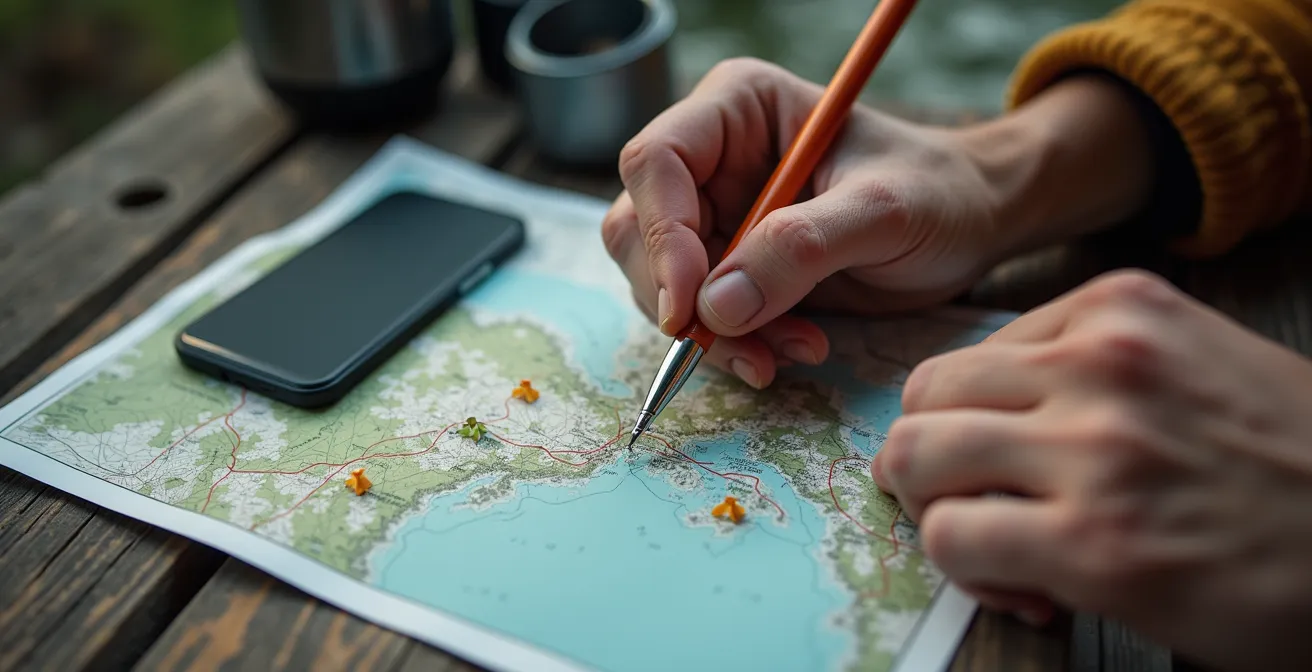
The second, more critical phase is verification. An offline map cannot show real-time road closures from rockslides or tell you if a station’s pumps are dry. Before entering a dead zone, use your last bar of service to check provincial resources like 511 Alberta or DriveBC and screenshot the conditions. Better yet, make a phone call. Hotel front desks or visitor centers in the last town are your best source of real-time, local knowledge. Ask them specifically: “Is the gas station at Saskatchewan River Crossing open and pumping today?” This simple call can save you from a catastrophic planning failure.
Highway 1 vs. Yellowhead Highway: Which Route is Better for Wildlife?
Choosing between Highway 1 (the main Trans-Canada route) and Highway 16 (the Yellowhead) through the Rockies isn’t just about scenery; it’s a strategic decision that impacts your risk of wildlife collisions and your access to services. There is no single “better” route, only the route that’s better for your risk tolerance and vehicle. Generally, Highway 1 through Banff is busier with more infrastructure, while the Yellowhead through Jasper is wilder and more remote.
Parks Canada data reveals specific seasonal risks. On Highway 1, expect higher black bear activity in the spring (May-June), especially as they feed on roadside vegetation in Yoho National Park. The Yellowhead, however, sees a spike in elk collisions during the autumn rut (September-October), with large bulls being dangerously unpredictable near Jasper. In winter, moose are drawn to the road salt on both highways, but the Yellowhead historically records significantly more moose strikes. Your choice of route should be informed by the time of year you’re traveling.
This data, summarized from wildlife advisories from Parks Canada, paints a clear picture:
| Factor | Highway 1 (Trans-Canada) | Highway 16 (Yellowhead) |
|---|---|---|
| Wildlife Collision Risk | Moderate – wildlife overpasses reduce risk | High – more animal crossings, fewer barriers |
| Peak Risk Times | Dawn/dusk in Yoho, night near Lake Louise | Dawn/dusk year-round, especially near Jasper |
| Service Frequency | Every 50-80km through Banff | Every 100-150km, longer remote stretches |
| Longest No-Service Stretch | Lake Louise to Golden (82km) | McBride to Tête Jaune Cache (165km) |
| Traffic Volume | Heavy in summer, moderate winter | Light to moderate year-round |
| Emergency Response Time | 30-45 minutes average | 60-90 minutes average |
The Yellowhead’s 165km stretch without services is a serious consideration. If you’re nervous about fuel, or driving a less reliable vehicle, the more frequent stops on Highway 1 offer a greater safety margin. If you’re confident in your vehicle and planning, the Yellowhead offers a more profound wilderness experience, with all the associated risks.
The Essential Trunk Kit: What Tools Must You Have for a 5,000 km Trip?
Your trunk kit for the Trans-Canada isn’t a standard roadside emergency bag; it’s a remote survival system. You must pack with the assumption that help is not coming quickly. In Northern Ontario, with average wait times for roadside assistance climbing to 3-6 hours according to CAA data, what you have in your car is all you have. Think in tiers of survival: self-rescue, fuel emergency, and human survival.
A proper kit goes far beyond jumper cables. It’s about self-sufficiency. At a minimum, your kit should be organized to handle the most likely and most dangerous scenarios:
- Self-Rescue Tier: This is for getting yourself moving again. A tire plug kit and a portable compressor are non-negotiable; they can fix a puncture that a simple spare can’t. Also include tow straps properly rated for your vehicle’s weight.
- Fuel Emergency Tier: A government-approved 20L jerry can is essential, but it must be paired with a proper mounting system (never store it inside the passenger cabin). Include a siphon pump and a bottle of Methyl Hydrate fuel antifreeze for winter travel.
- Human Survival Tier: This assumes you’re stranded for an extended period. Pack a 72-hour food supply with high-energy, no-cook items like pemmican bars, a LifeStraw or other water filter, and a -20°C rated sleeping bag, even in summer. Hypothermia is a year-round risk.
- Communication Tier: When there’s no cell signal, you need alternatives. A satellite messenger like an InReach or SPOT device is the gold standard for calling for help. For low-tech backup, a powerful emergency whistle, a signal mirror, and road flares are essential. A CB radio is also invaluable for communicating with truckers on Channel 19.
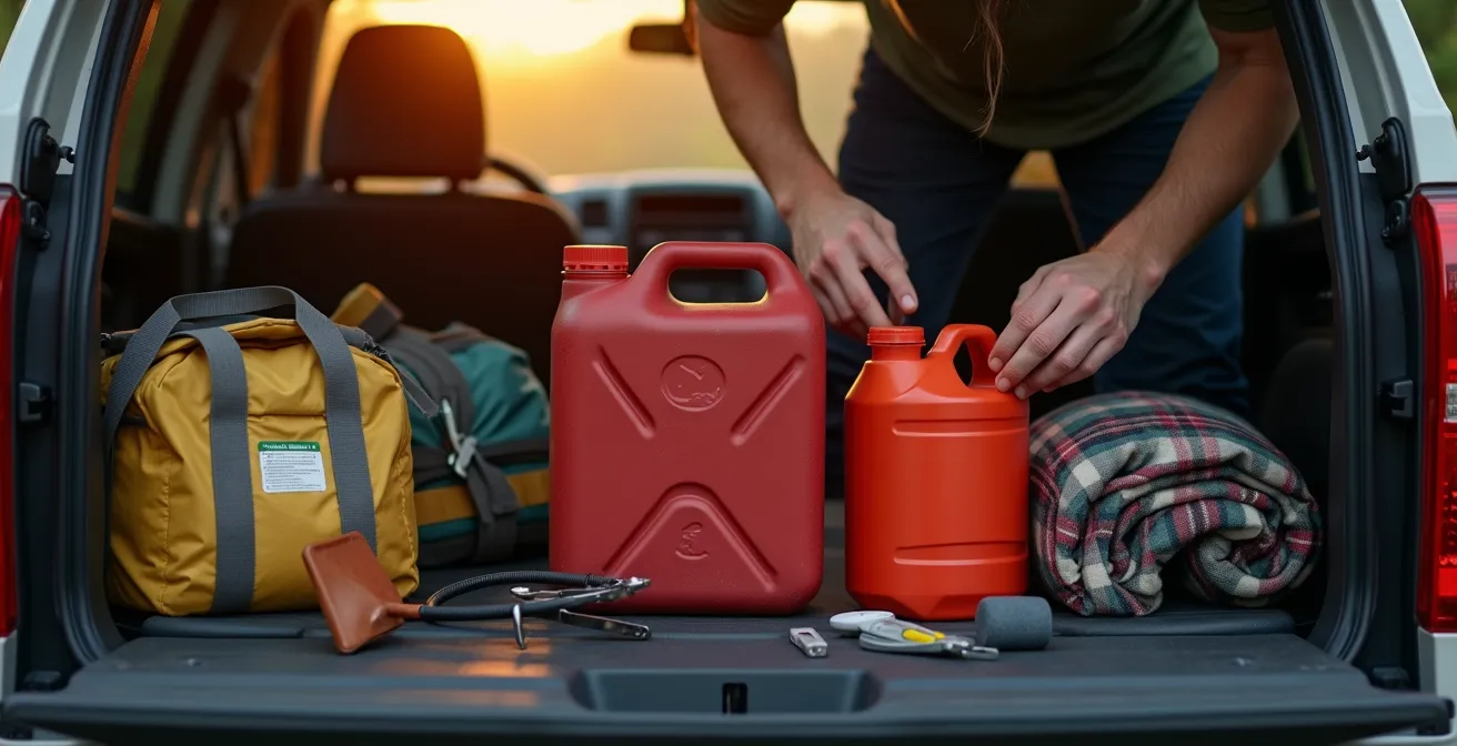
Building this kit isn’t about paranoia; it’s a fundamental sign of respect for the vast, unforgiving distances of the Canadian landscape. It acknowledges that you are the first and most important line of defense in an emergency.
Crossing Ontario: How Many Days Does It Really Take to Drive Across the Province?
Here’s the hard truth about crossing Ontario: throw Google Maps’ estimate in the garbage. The drive from the Quebec border to the Manitoba border is the single greatest endurance test of the entire Trans-Canada trip. While digital maps might suggest a breezy 18 hours of driving, realistic travel time is closer to 22-25 driving hours based on the reports of countless drivers who have done it. This discrepancy isn’t just traffic; it’s the nature of Highway 17.
The most notorious section is the 480km stretch from Sault Ste. Marie to Thunder Bay, often called the “Northern Ontario Gauntlet.” It’s a grueling, mostly two-lane highway with limited passing opportunities. You will get stuck behind truck convoys. You will hit construction zones that bring traffic to a standstill. And you will have to slow down for wildlife. These factors add hours, not minutes, to your trip. Pushing through this in one day is not just exhausting; it’s dangerous, as fatigue dramatically increases your risk of a fatal error.
Experienced drivers treat the Ontario crossing as a multi-day journey, not a sprint. The consensus strategy is to break the Gauntlet with a mandatory overnight stop. The small towns of Wawa or Marathon are perfectly positioned for this. Stopping allows you to tackle the most demanding stretches of road well-rested and alert. It also breaks the profound psychological toll that the monotonous shield landscape takes on a driver.
Planning for two full days of hard driving, or even a more relaxed three days, is a realistic and safe approach. Trying to “power through” is a gamble against fatigue, wildlife, and the unpredictable nature of the North. It’s a gamble you’re likely to lose.
Combating Monotony: How to Stay Alert on Straight Roads for 8 Hours?
After a few hours on a straight, empty highway, your brain starts to crave stimulation. If you don’t provide it, it will create its own—daydreaming, zoning out, and eventually, succumbing to highway hypnosis. The key to staying alert is not just caffeine; it’s an active strategy of engagement. This involves both what you listen to and how you physically interact with the journey.
Long-haul truckers have perfected the “Micro-Stop Strategy,” or what I call a “Cognitive Reset.” The principle is to stop roughly every 90 minutes, which aligns with natural human attention cycles. The key is where you stop. Don’t just pull into a generic rest area. Choose spots with immediate visual or physical impact: a waterfall, a scenic lookout, a historical marker. Places like the Aguasabon Falls & Gorge near Terrace Bay are perfect. A quick 10-minute walk provides more mental stimulation and does more to fight fatigue than a 20-minute nap in a parking lot.
Your audio is your co-pilot. A generic music playlist will quickly become background noise. You need content that forces your brain to actively listen and process information. A Canada-specific audio strategy is your best weapon against monotony.
Action Plan: Your Anti-Monotony Audio Strategy
- List Sources: Identify all your potential audio inputs before you leave (podcast apps, audiobook library, music streaming, radio apps).
- Collect & Download Content: Inventory and download a rich variety of Canada-specific content. Don’t rely on streaming. This includes podcasts like CBC’s ‘The Secret Life of Canada’ and audiobooks by authors set in the regions you’re crossing (e.g., Joseph Boyden for Northern Ontario, W.O. Mitchell for the Prairies).
- Ensure Route Coherence: Match your audio content to your physical location to create a deeper connection. Listening to stories about the region you’re in makes the landscape meaningful rather than monotonous.
- Evaluate for Alertness: Create playlists that intentionally mix high-engagement talk (podcasts, audiobooks) with music. Weave in segments from local CBC Radio One stations to maintain a connection to the local area and break up long content blocks.
- Integrate & Schedule: Finalize all downloads and create your ordered playlists well before you enter known no-service zones. Your audio plan should be as set as your fuel plan.
By actively managing your stops and your audio, you are taking control of your mental state, transforming a passive, draining drive into an active, engaging journey.
High Beams vs. Fog Lights: Which Is Better for Illuminating Fur?
On a dark, remote Canadian highway, your headlights are your most important piece of safety equipment. A collision with a moose or elk is often fatal for both the animal and the car’s occupants. But using the right light for the right situation is a science that most drivers get wrong. It’s not as simple as “more light is better.” High beams and fog lights are designed for different jobs, and knowing which to use is critical for spotting wildlife in time.
High beams are for distance. They project light far down the road, which is excellent for spotting the reflective “eyeshine” of a distant animal on the long, straight stretches of the Prairies. However, in fog, snow, or heavy rain, they create a blinding wall of glare, making things worse. Fog lights, by contrast, are designed to cut underneath that glare. They project a wide, low beam that illuminates the ground directly in front of your vehicle—and, crucially, the legs and body of an animal.
In Northern Ontario and Vancouver Island’s narrow roads, fog lights aimed low are essential – they illuminate the critical ‘strike zone’ below the dazzling eyeshine where you can identify the animal’s size and position.
– Mark Richardson, Canada’s Road: Journey on the Trans-Canada Highway
This expert insight is key. Eyeshine tells you something is there, but it doesn’t tell you what it is or where it is on the road. Illuminating the body with fog lights allows you to identify the threat—a 1,000-pound moose requires a different reaction than a 40-pound coyote. The ideal technique in clear weather is to scan with high beams for distant eyeshine, and as you get closer, use your fog lights to identify the body and position.
| Light Type | Best For | Range | Animal Detection | Weather Performance |
|---|---|---|---|---|
| High Beams | Prairie straight roads | 150-200m | Excellent for eyeshine | Poor in fog/snow |
| Fog Lights | Winding forest roads | 20-40m | Good for legs/body | Excellent in fog |
| LED Light Bars | Alaska Highway, Trans-Lab | 300-400m | Superior all-around | Good if aimed properly |
| Adaptive Headlights | Mountain passes | Variable | Good with auto-adjust | Moderate all conditions |
Key Takeaways
- The biggest risks on a cross-country drive are psychological: highway hypnosis from monotony and a false sense of security that leads to underestimating distance.
- Technology is only a tool, not a saviour. Always verify digital information like offline maps with real-world, human intelligence before entering remote areas.
- Your emergency kit isn’t for convenience; it’s a survival system built to withstand a potential 3-6 hour wait for help in places like Northern Ontario.
Renting an RV in Alberta: What Size Vehicle Fits National Park Campsites?
Renting an RV to explore the Rockies is a classic Canadian adventure, but it comes with its own set of logistical traps. The size of your RV directly impacts where you can stay, how much fuel you’ll burn, and how stressful your drive will be. The most common mistake is renting a vehicle that’s too large for the infrastructure of the national parks, especially on iconic routes like the Icefields Parkway.
The first rule is to be deeply skeptical of campsite size descriptions. A Parks Canada survey reveals that only 65% of ’35-foot’ designated sites can actually accommodate a 28-foot RV that is also towing a vehicle. You must factor in your total combined length. Furthermore, site geometry matters; a tricky back-in site requires far more maneuvering space than a simple pull-through. For maximum flexibility and access to the most scenic, rustic campgrounds, a vehicle with a total length of 25 feet or less is the gold standard.
Fuel planning in an RV is a different beast. A 30-foot Class C RV might get 12 MPG on the flat prairies, but that economy can plummet to 8 MPG or worse on the steep mountain grades of the Icefields Parkway. The 230km trip from Jasper to Lake Louise is a perfect example. That journey requires a full 100L tank, because the only fuel stop at Saskatchewan River Crossing often charges a 30-40% premium. The climb to Bow Summit alone can devour 15L of fuel. Smart RV drivers start with a full tank and still carry a jerry can as a backup.
When choosing your rental, consider these points:
- Book campsites at major hubs like Tunnel Mountain (Banff) or Whistlers (Jasper) for reliable accommodation for larger rigs (35+ feet).
- For backcountry sites along the Icefields Parkway, a smaller, more nimble RV under 25 feet is essential.
- Always verify your total combined length (RV + any towed vehicle) against the campsite’s maximum length.
- Consider Calgary-based rental companies like RVezy, which often have newer, more fuel-efficient models and valuable local knowledge.
So, before you turn the key for that once-in-a-lifetime trip, do more than just map your route. Plan your mindset, prepare for the worst-case scenario, and respect the vastness of the land you’re about to cross. That’s the difference between just driving the Trans-Canada and truly conquering it.
Frequently Asked Questions About Driving the Trans-Canada
What happens if the gas station marked on my offline map has run out of fuel?
Call hotels or visitor centers in the last town with cell service before entering dead zones. They have real-time local knowledge about fuel availability and can warn you about temporary outages or closures that an offline map will never show.
Can offline maps show road closures due to rockslides or avalanches?
No, offline maps cannot show real-time hazards. Check provincial road condition websites like 511 Alberta or DriveBC before losing signal and take screenshots of the current conditions. For critical mountain passes, consider calling Parks Canada directly for the latest updates.
Which offline map app works best for Canadian backcountry?
Maps.me and Gaia GPS are widely preferred by Canadian locals for their detailed trail and logging road data. Google Maps offline is reliable for main highways like the Trans-Canada, but it lacks the crucial detail on service roads and emergency alternate routes you might need.