In summary:
- A successful lighthouse road trip in Nova Scotia requires strategic planning that goes beyond just visiting the most famous spots.
- Understanding the history, like the revolutionary Fresnel lens, adds depth to your journey and appreciation for each location.
- For photographers, choosing a lighthouse depends on your goal: Peggy’s Cove for iconic shots (with crowds) or Cape Forchu for dramatic landscapes.
- Safety is paramount; always respect coastal warnings like the “Black Rock” rule and understand tide patterns before you go.
- Mastering logistics, from bypassing traffic to planning fuel stops on remote routes, is the key to a stress-free and rewarding trip.
The beam cuts through the thick Atlantic fog, a solitary pulse of light against the immense dark. For many, this is the quintessential image of Nova Scotia. Our coastline is dotted with these sentinels, each with a story to tell. But planning a road trip to see them often devolves into a checklist-driven tour of the most famous locations, a race to get the same postcard shot as everyone else. You’ll see Peggy’s Cove, maybe drive a section of the Lighthouse Route, and call it a day.
As a maritime historian and photographer living in Halifax, I believe this approach misses the soul of our lighthouses. The real magic isn’t just in the structure, but in its narrative—the technology that powers its light, the treacherous waters it guards, and the logistical choreography required to capture its essence. What if the goal wasn’t just to see a lighthouse, but to understand its place in our history and capture a truly unique image?
This guide is designed for the discerning road-tripper, the one with a camera in hand and a curiosity for the stories etched into our granite shores. We’ll go beyond the obvious and design a trip that prioritizes informed detours over crowded turnouts. We’ll explore the revolutionary science of their light, compare iconic locations for the best photographic potential, and cover the critical on-the-ground logistics—from safety on the rocks to saving money and bypassing our local version of rush-hour traffic. Forget the checklist; let’s plan an expedition to capture the true narrative of light, focusing on five key beacons: Peggy’s Cove, Cape Forchu, Neils Harbour, Gabarus, and Cape Sable.
This article provides a complete roadmap for your journey. To help you navigate, the summary below outlines the key topics we will cover, from the historical technology behind the beacons to the practicalities of planning your route.
Summary: A Strategic Guide to Nova Scotia’s Lighthouses
- Why Were Fresnel Lenses Revolutionary for Atlantic Navigation?
- How to Map a Lighthouse Route Along the Cabot Trail efficiently?
- Peggy’s Cove vs. Cape Forchu: Which Lighthouse Offers a Better Sunset?
- The “Black Rock” Rule: How to Avoid Sweeping Waves at Lightstations
- Capturing Lighthouses: The Best Camera Settings for Foggy Mornings
- Sailing Mid-Week: How Much Can You Save by Traveling Tuesday Morning?
- The QEW Nightmare: How to Bypass Toronto Traffic on Friday Afternoons?
- Driving the Trans-Canada Highway: How to Plan Fuel Stops in Remote Areas?
Why Were Fresnel Lenses Revolutionary for Atlantic Navigation?
The Fresnel lens was a quantum leap in optical technology that transformed maritime safety along the treacherous Atlantic coast. Before its invention, lighthouses used simple mirrors or reflectors, which were incredibly inefficient. The groundbreaking design of French physicist Augustin-Jean Fresnel, first demonstrated in 1822, used a series of concentric glass prisms and a central lens to capture and focus a lamp’s light into a single, powerful beam. This was a game-changer for sailors navigating our often-foggy shores.
The efficiency of this system was astounding. While older methods struggled to project a fraction of the available light, an analysis of the technology shows the revolutionary invention captured over 83% of a lamp’s light, compared to just 17% for the best reflectors of the time. This meant light could be seen from much farther away, providing critical extra time for ships to identify their position and avoid hazards. Each lens could also be crafted to produce a unique flash pattern, giving lighthouses an individual signature that was as good as a name on a map.
While many of these delicate, beehive-like structures have been replaced by modern optics, you can still witness this history firsthand in Nova Scotia. The Cape Sable lighthouse on Cape Sable Island houses the only operational Fresnel lens in the province. Climbing the iron stairs, just as keepers did for decades, allows you to see the intricate clockwork mechanism and glass prisms up close—a tangible connection to the “narrative of light” that has guided mariners for nearly two centuries.
How to Map a Lighthouse Route Along the Cabot Trail efficiently?
Mapping an efficient route along the Cabot Trail is a masterclass in logistical choreography, especially for a photographer chasing the light. A common mistake is to simply drive the loop without a plan, resulting in harsh midday light and missed opportunities. An efficient approach involves timing your drive to match optimal photographic conditions, planning for sparse services, and knowing which detours are truly worthwhile. The drive itself can be challenging with its steep grades and sharp turns, so a strategic plan also enhances safety.
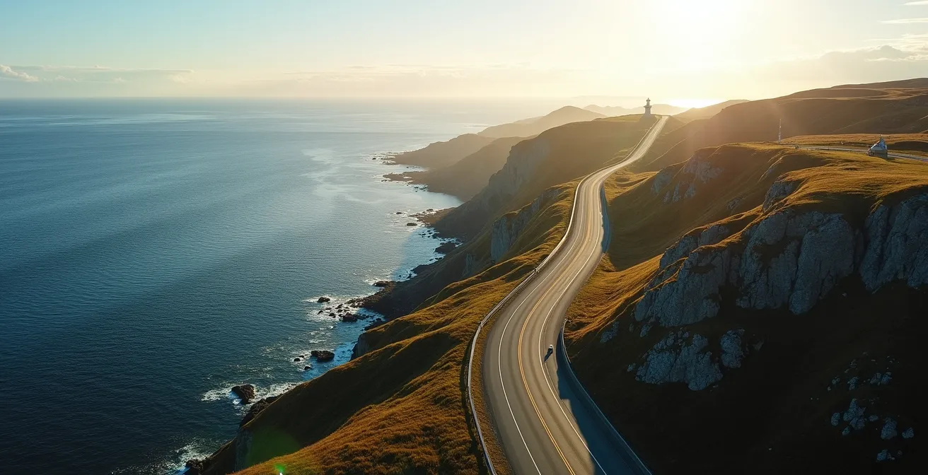
From a photographer’s perspective, the direction you travel is critical. I always recommend a counter-clockwise route starting from the Halifax side. This puts you on the eastern shore of Cape Breton in the morning, bathing lighthouses in beautiful, soft light. It also positions you perfectly for sunset on the western side, particularly near Chéticamp and its surrounding coastal views. This simple choice can dramatically elevate the quality of your images.
Beyond direction, practical planning is key. The northern part of the Cabot Trail is beautifully wild but has very few services. Here are some key planning points:
- Start Counter-Clockwise: Drive against the clock for optimal morning light on the east coast and sunset on the west.
- Make an Informed Detour: The Gabarus Lighthouse is a 20-minute detour that offers incredible solitude and a sense of rugged isolation that’s hard to find elsewhere.
- Time Your Arrival: Aim to be at the Neils Harbour lighthouse in the late afternoon. The warm light on the colourful fishing boats with the lighthouse in the background is a classic Cape Breton shot.
- Check for Dead Zones: Cell service is notoriously spotty, especially in Cape Breton Highlands National Park. Download offline maps and plan your communication before you enter known dead zones.
Peggy’s Cove vs. Cape Forchu: Which Lighthouse Offers a Better Sunset?
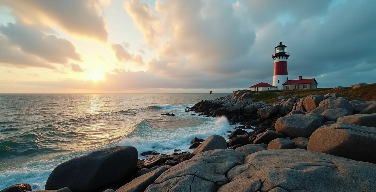
This is a classic Nova Scotian debate, and the answer depends entirely on what you’re looking for as a photographer and traveler. Peggy’s Cove offers the iconic, world-famous postcard shot on its smooth granite barrens, while Cape Forchu provides a dramatic, exploratory experience on unique volcanic rock. Neither is “better,” but they offer profoundly different sunset experiences, especially considering crowd levels and accessibility.
Peggy’s Cove is undeniably beautiful and, as the most photographed lighthouse in Canada, a must-see for many. However, its popularity is also its biggest challenge. As travel writer Suzanne Jones notes in The Travelbunny Nova Scotia Guide, you can expect shoulder-to-shoulder crowds in August, with the car park often full by 9:30 a.m. For a sunset shoot, you will be sharing the view with hundreds of others. Cape Forchu, located near Yarmouth, is a longer drive from Halifax but rewards the effort with more space and a uniquely rugged landscape.
To make an informed decision, this comparison breaks down the key differences between the two premier sunset spots.
| Feature | Peggy’s Cove | Cape Forchu |
|---|---|---|
| Crowd Level (August) | Shoulder-to-shoulder by 9:30am | Moderate, ample space |
| Geology | Granite barrens | Volcanic rock formations |
| Accessibility | 45-min from Halifax | 3.5 hours from Halifax |
| Special Features | Most photographed in Canada | Only lighthouse with lantern room tours |
| Best For | Iconic postcard seekers | Dramatic explorers |
Ultimately, your choice reflects your travel style. If you want that one perfect, famous shot and don’t mind the crowds, Peggy’s Cove is your destination. If you prefer a more adventurous, dramatic, and personal encounter with the landscape, the extra drive to Cape Forchu is well worth it. It’s the only lighthouse in the province where you can actually tour the lantern room, offering a true “keeper’s perspective.”
The “Black Rock” Rule: How to Avoid Sweeping Waves at Lightstations
Visiting Nova Scotia’s lighthouses means getting close to one of the most powerful forces on earth: the Atlantic Ocean. The infamous “Black Rock” rule at Peggy’s Cove—a warning to stay off the dark, wet rocks—is a stark reminder of this power. These rocks are dark because they are consistently washed by waves, including unexpected rogue waves that can sweep onlookers into the dangerously cold water. This rule isn’t just a suggestion; it’s a critical safety protocol for any coastal exploration in the province.
From a historian’s perspective, this danger is the very reason these lighthouses exist. They were built to guide ships away from the same treacherous shores we now visit as tourists. Adopting a “keeper’s perspective” means treating the coast with profound respect and vigilance. Before you even set foot on the rocks, your safety planning should have already begun. This involves checking tide charts and marine forecasts, as swell height and wave period are better indicators of danger than just looking at the water in the moment.
A beautiful day can be deceptive. A calm-looking sea can hide powerful underlying swells generated by storms hundreds of kilometers away. Your most reliable guide on-site is the rock itself. The line between wet and dry rock is the ocean’s high-water mark. Staying well clear of this line is non-negotiable. To ensure your visit is memorable for the right reasons, follow a strict safety protocol.
Your Action Plan: Coastal Safety at Lightstations
- Check tide charts from the Canadian Hydrographic Service before you leave. Know whether the tide is rising or falling.
- Monitor marine forecasts for swell height and period. A long period (e.g., 10-15 seconds between waves) can indicate powerful, deep-water energy.
- Identify wet vs. dry rock zones upon arrival. The wet rocks are a clear sign of the waves’ recent reach.
- Maintain a minimum distance of 10 meters (about 30 feet) from any wet rock surfaces, even if the sea looks calm.
- Watch for rogue wave patterns before approaching the coast. Observe the water for several minutes and count wave sets to understand its rhythm.
Capturing Lighthouses: The Best Camera Settings for Foggy Mornings
For many photographers, a foggy morning on the Nova Scotian coast is not a disappointment; it’s an opportunity. Fog, or “sea smoke” as it’s often called here, creates an ethereal atmosphere that can transform a standard lighthouse scene into a work of art. However, “atmospheric capture” requires a different technical approach than shooting on a clear day. Autofocus systems struggle, light is low, and details can easily be lost. The key is to take manual control of your camera to bring out the mood and texture of the scene.

Your first challenge will likely be focus. In dense fog, autofocus will often hunt back and forth, unable to lock on. This is where manual focus or focus bracketing becomes invaluable. By taking several shots with slightly different focal points, you ensure at least one is perfectly sharp. Another crucial tool is a Circular Polarizing (CPL) filter. While often used to cut glare on sunny days, in fog, a CPL filter can be used to enhance saturation and contrast, making the lighthouse pop against the grey backdrop without eliminating the atmospheric haze.
To translate the scene in your mind to a stunning final image, consider these technical settings as your starting point:
- Shoot in RAW: This is non-negotiable. A RAW file retains the maximum amount of data, allowing you to recover details in the fog and adjust white balance in post-processing without losing quality.
- Use a Moderate ISO: Set your ISO between 400 and 800. This helps maintain a fast enough shutter speed to avoid motion blur in low light without introducing excessive noise.
- Employ Focus Bracketing: When autofocus fails in the dense sea smoke, bracket your focus manually to guarantee a sharp image.
- Include Foreground Elements: To give a sense of scale and place, include iconic maritime elements like lobster traps, fishing dories, or weathered pier pilings in your foreground.
Sailing Mid-Week: How Much Can You Save by Traveling Tuesday Morning?
While the title mentions “sailing,” the principle applies to any form of travel on a Nova Scotia road trip: avoiding peak times is the single best way to improve your experience and lower your costs. Traveling mid-week, particularly on a Tuesday or Wednesday, is a core tenet of logistical choreography. The difference between a Saturday morning at Peggy’s Cove and a Tuesday morning is night and day, both in terms of crowds and cost.
The financial benefits are significant. During the shoulder seasons of late spring and early fall, data shows that lighthouse town accommodations in places like Lunenburg and Baddeck drop by 20-30% for mid-week bookings compared to weekends. This can add up to substantial savings over the course of a multi-day road trip, money that can be better spent on a memorable meal or a local craft.
But the real value is experiential. Consider the case study of a typical Peggy’s Cove visit. On a weekend, the parking lot can be full by 9:30 a.m., forcing you to park far away and navigate a sea of people just to get a glimpse of the lighthouse. Visiting on a Tuesday morning at 8 a.m. offers a completely different world. You’ll have your choice of parking, the granite rocks will be blissfully empty, and you can take your time composing photographs without a dozen selfie sticks in your frame. It allows for a more contemplative, personal connection with the place, much closer to the solitary experience a lightkeeper would have had.
The QEW Nightmare: How to Bypass Toronto Traffic on Friday Afternoons?
While we may not have the Gardiner Expressway or the QEW, Halifax has its own version of the “Friday afternoon nightmare.” The traffic heading out of the city towards the South Shore (and Peggy’s Cove) or the Annapolis Valley can be painfully slow, especially on a summer weekend. As a local, I can tell you that getting caught in this exodus can add an hour or more to your drive and start your road trip on a frustrating note. Knowing the local bypass routes is insider knowledge that can save you time and sanity.
Nova Scotia is a driving province. As Carolyn Ray of JourneyWoman Travel Guide rightly points out, while shuttles exist, you’ll want a car to properly explore. The key is knowing how to use it smartly. Instead of joining the bumper-to-bumper crawl on Highway 103 to get to the Peggy’s Cove area, take the much more scenic Route 333 coastal road directly from Halifax. It’s a slightly longer drive in distance, but it moves steadily and offers stunning coastal views along the way, turning a traffic jam into a scenic prologue to your trip.
Here are some proven strategies for avoiding our local traffic bottlenecks:
- Leave Halifax Before 3 p.m. or After 7 p.m. on Fridays: This is the simplest rule to avoid the worst of the outbound rush.
- Take the Scenic Route: Use Route 333 (the “Lighthouse Route”) to get to Peggy’s Cove and the Bluenose Coast instead of the main Highway 103.
- Use Marine Drive for the Cabot Trail: To get to Cape Breton, the eastern Marine Drive route has significantly less traffic than the main highway through Truro.
- Consider a Thursday Departure: If your schedule allows, starting your trip on a Thursday completely sidesteps the weekend rush.
- Start from Yarmouth: For a truly creative bypass, consider taking the ferry from Bar Harbor, Maine, to Yarmouth and starting your road trip from the opposite end of the province, avoiding Halifax entirely at the outset.
Key takeaways
- True exploration of Nova Scotia’s lighthouses requires more than a checklist; it demands a strategy that blends history, photography, and logistics.
- Safety is not optional. Understanding and respecting the power of the Atlantic by obeying warnings like the “Black Rock” rule is fundamental.
- The best photographic opportunities often come from embracing challenging conditions like fog and planning your route around the movement of light, not just the shortest distance.
Driving the Trans-Canada Highway: How to Plan Fuel Stops in Remote Areas?
While the Trans-Canada Highway cuts through Nova Scotia, the real adventure—and the most spectacular lighthouses—are found on the winding coastal routes like the Eastern Shore’s Marine Drive and the northern loop of the Cabot Trail. These drives are the heart of a maritime road trip, but they require careful planning for one crucial resource: fuel. Unlike the main highway, gas stations on these remote stretches can be few and far between, and running out of gas is a surefire way to ruin a day of exploration.
This is the final, critical piece of your logistical choreography. With Nova Scotia’s vast 7,500 km of coastline and over 150 lighthouses, you will inevitably find yourself in a remote area. My steadfast rule for driving these routes is to never let the tank drop below half. When you see a gas station, use it. Waiting for the next one can be a gamble, especially since cell service often disappears in the same areas where fuel is scarce, making a call for help impossible.
To avoid any anxiety, build your fuel stops into your itinerary as strategic pauses. Pair them with a meal or a short walk to stretch your legs. Here are the most critical fuel stops to have on your map:
- Sherbrooke: This is your last truly reliable station before diving into the wilderness of Marine Drive. It’s a perfect place to fill up and grab a bite at the historic Sherbrooke Village Café.
- Chéticamp: The Co-op gas station in Chéticamp is your final chance to fuel up before tackling the northern loop of the Cabot Trail, where services are non-existent.
- Download Offline Maps: Before you leave a service area, make sure your route for the next few hours is downloaded. Cell service can vanish completely past Sheet Harbour on the Eastern Shore.
- Adopt the Half-Tank Policy: Treat half a tank as “empty” when you’re on the Eastern Shore or Cabot Trail. This simple rule prevents almost all potential fuel-related issues.
Now that you’re equipped with the historical context, photographic techniques, and logistical strategies, you’re ready to plan an expedition that goes beyond the surface. The next step is to start mapping your own informed detours and building an itinerary that tells your personal story of Nova Scotia’s lighthouses.